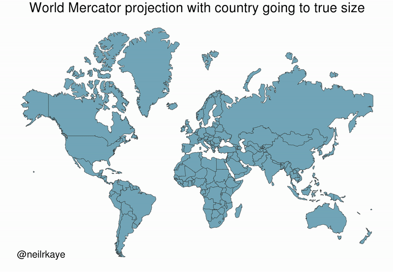
This gif graphically shows how our standard Mercator projection maps distort the size of lands away from the equator.
How clever is that?!
September 23, 2023
This gif graphically shows how our standard Mercator projection maps distort the size of lands away from the equator.
How clever is that?!
September 23, 2023
So the smaller is what the size of those areas really are? That is quite clever.
Yes, it’s the size they are on a globe. They look bigger when projected on the standard map.
since this is the first time i have heard of this map, i went out to see what it is and now my brain hurts.. ha ha….i read the good, the bad and the ugly and decided i will never be using one. yes, this gif is really clever
🙂
Curious, the gap between the US and Canada — while there is very little in the Southern Hemisphere.
Beyond my capacity … but clever!!
On the standard map things look bigger the farther they are from the equator, the closer they are to the poles.
Good grief, I never heard the like!!!
I remember being taught that in 4th or 5th grade, I think. I still remember Greenland, but I was still surprised now how much it affects Canada. Fun stuff!
Very!
🙂